
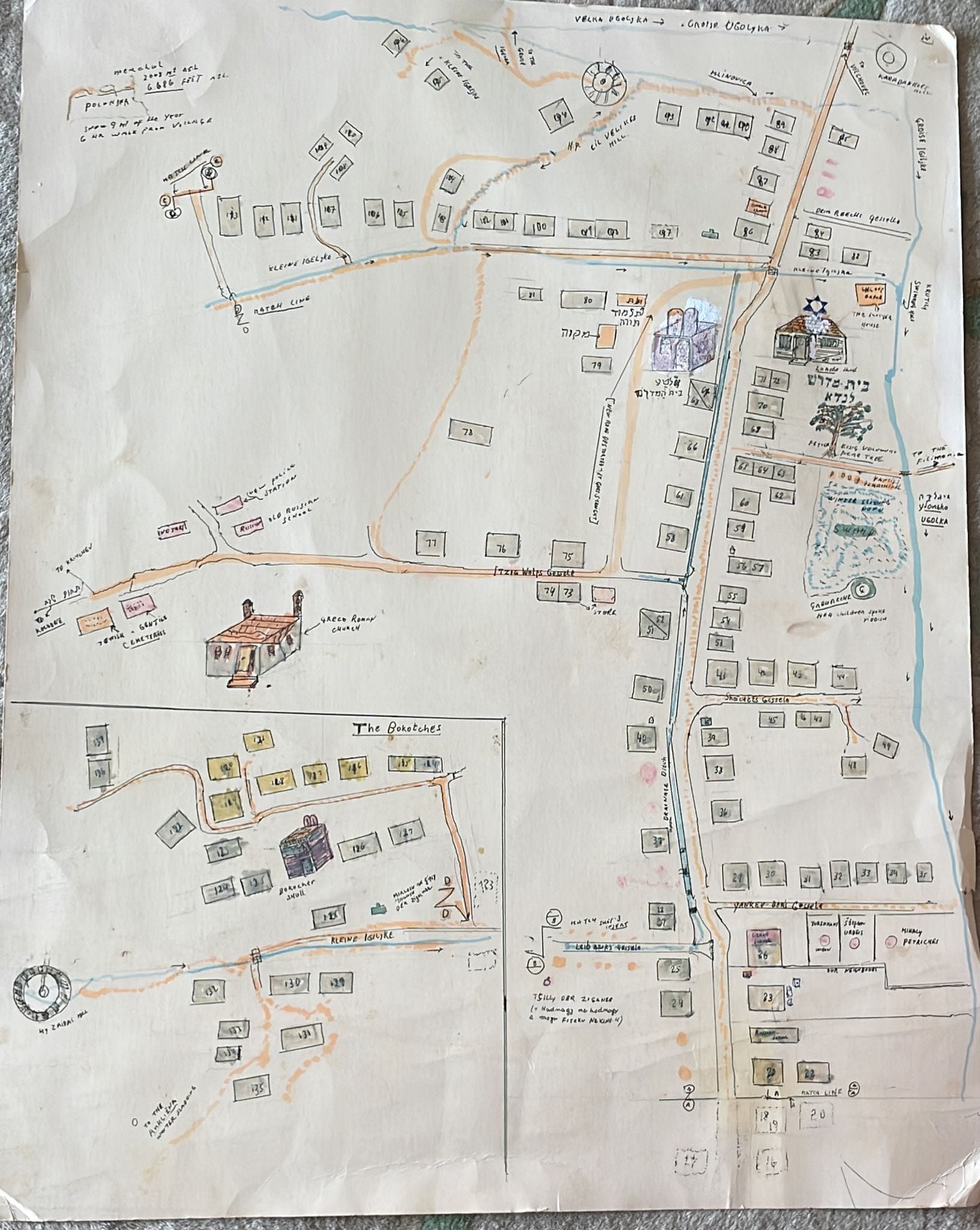
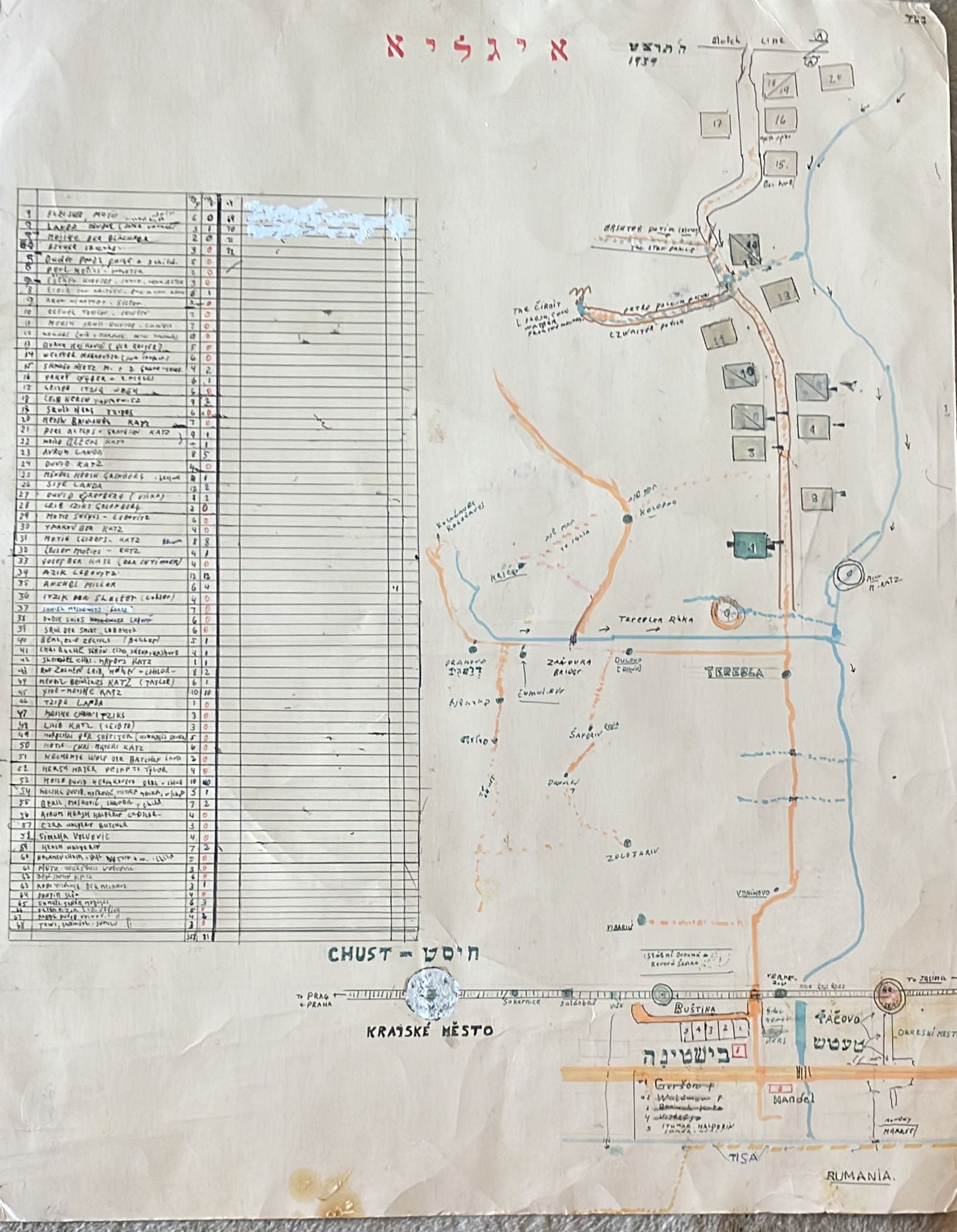
Here’s a map of Iglya as it was before the war drawn by Zeida by memory. Baba kept it tucked in the thin space between the dining room display cabinet and the wall, and would on occasion pull it out to show me .
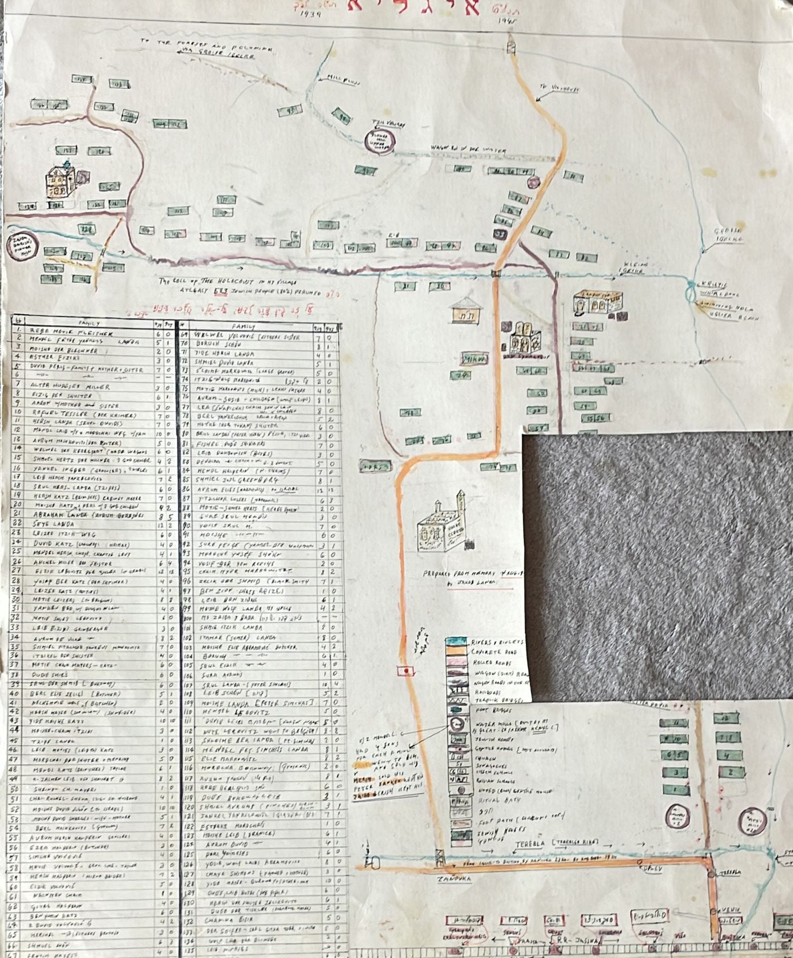
Google maps has always been hard to interrogate, because the borders and languages were so constantly shifting (Baba used to talk about how good things were under Franz Josef - the Austro Hungarian emperor.)
Here are some other things I know:
-Bishtana was the nearest town where they would go to catch the train, or sell lumber, or any number of other things
-Various rivers played outsized roles in the geography and life of Baba. The Tereble (this?) river was the big one but not the one in the village which was smaller
-Khust was further, and featured in some stories
At individual moments I couldn’t find it on Google maps, but all of these together… I think this must be here. You could imagine crossing the Tereblya and then heading south to Bishtana. Khust would be further from Bishtana, assuming you stayed in the valley and didn’t cross the mountains.